
Fredrik Schenholm/Westsweden.com
Håvedalen - Krokstrand
- Length
- 11 km
- Degree of difficulty
- Red
- Estimated time
- 3–4h
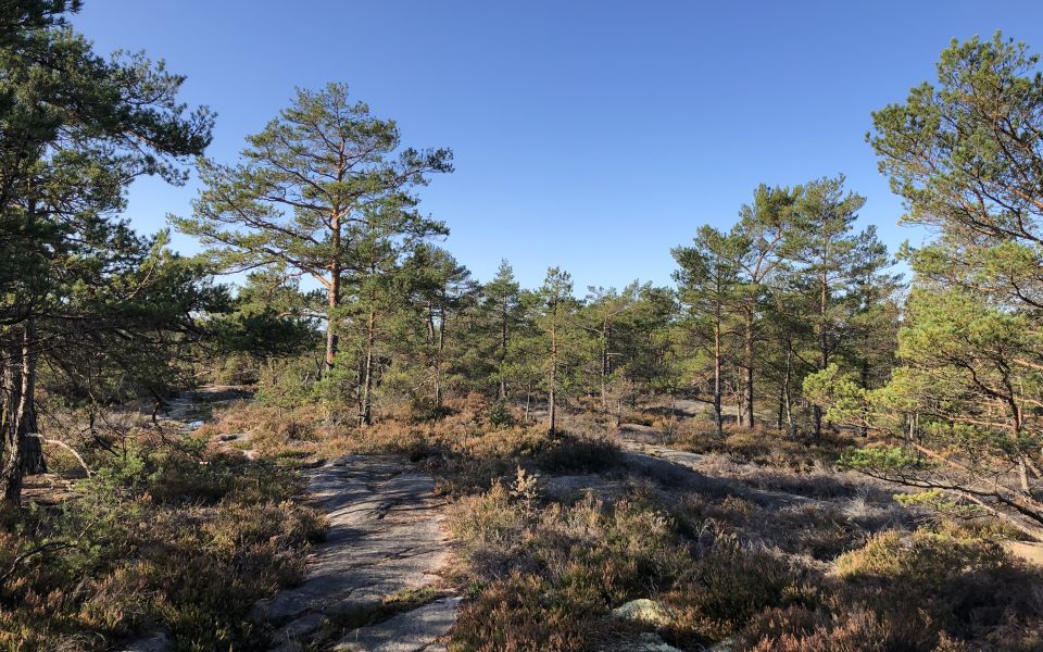
Huge differences in height, beautiful views and stonework history meet the hiker on this relatively short but still demanding stage.
The 25thsection of the Bohusleden Trail takes the walker between Håvedalen and Krokstrand in the District of Strömstad.
The walk from Håvedalen starts through beautiful wooded terrain along an old toll road. Customs men patrolled here in the past, to guard the Norwegian border, one kilometre to the east. The Trail soon leaves the woodland and quickly starts to ascend. A tough climb takes you up and over the bare or moss-covered rocks. Soon the Trail descends again, and the surroundings are more like an enchanted forest.
When the woodland opens up, the long, narrow and deep Idefjorden lies in front of you, a part of the sea, but far inland. The Trail then follows the shore of Idefjorden, up and down steep slopes until you reach the small community of Krokstrand.
Almost everywhere in Krokstrand, evidence of the stonemason period in Bohuslän can be seen. Krokstrand was one of the communities where stonemasonry was at its greatest.
Surface: This sections is on dirt roads and forest paths.
Time: It takes approximately 3-4 hours to hike this section.
Not to be missed: A detour to the hut/shelter at Sandvatten.
How to get here: Near Håvedalen you find the bus stops Håvedalen and Allemarksvägen. In Krokstrand, there are bus stops called Skog, Krokstrand and Björneröd. For more information on transport, see the map planning tool.
Accommodation: There are no proposed accommodations along this stage.
11 km
Degree of difficulty
About Difficulty Grading
The grading is tailored for Swedish lowland trails that adhere to the quality criteria established by the national framework for hiking trails.
Even and firm ground: The terrain is generally flat. The hike requires no need to use your hands for support. No obstacles. Bridges are always present when crossing waterways.
Uneven and/or soft ground: Some changes in elevation. Certain sections may require hand support to maintain balance. There may be obstacles such as low stiles and short stairs. Minor obstacles like stones and roots. Boardwalks are present.
Loose or slippery ground combined with steep sections: Technical parts require hand support. There may be obstacles such as high stiles and longer stairs. Frequent sections with stones and/or roots. Boardwalks with deeper surrounding water.
Note: One or more of these features may be present along the trail section.
Red
3–4h
- Historia
- Skog
- Utsikt
- Vindskydd
- Vandringsled
- Bohusleden
- Utsikt
- Skog
- Vindskydd
- Vandringsled
- Historia
- Bohusleden
- Utsikt
- Skog
- Vindskydd
- Vandringsled
- Historia
- Bohusleden
- Utsikt
- Skog
- Vindskydd
- Vandringsled
- Historia
- Bohusleden
- Utsikt
- Skog
- Vindskydd
- Vandringsled
- Historia
- Bohusleden
- Utsikt
- Skog
- Vindskydd
- Vandringsled
- Historia
- Bohusleden
- Utsikt
- Skog
- Vindskydd
- Vandringsled
- Historia
- Bohusleden
- Utsikt
- Skog
- Vindskydd
- Vandringsled
- Historia
- Bohusleden
- Utsikt
- Skog
- Vindskydd
- Vandringsled
- Historia
- Bohusleden
- Utsikt
- Skog
- Vindskydd
- Vandringsled
- Historia
- Bohusleden
- Utsikt
- Skog
- Vindskydd
- Vandringsled
- Historia
- Bohusleden
- Utsikt
- Skog
- Vindskydd
- Vandringsled
- Historia
- Bohusleden
- Utsikt
- Skog
- Vindskydd
- Vandringsled
- Historia
- Bohusleden
- Utsikt
- Skog
- Vindskydd
- Vandringsled
- Historia
- Bohusleden
- Utsikt
- Skog
- Vindskydd
- Vandringsled
- Historia
- Bohusleden
- Utsikt
- Skog
- Vindskydd
- Vandringsled
- Historia
- Bohusleden
- Utsikt
- Skog
- Vindskydd
- Vandringsled
- Historia
- Bohusleden
Highlights along the section
Here are some places that are frequently visited and appreciated by others.